|
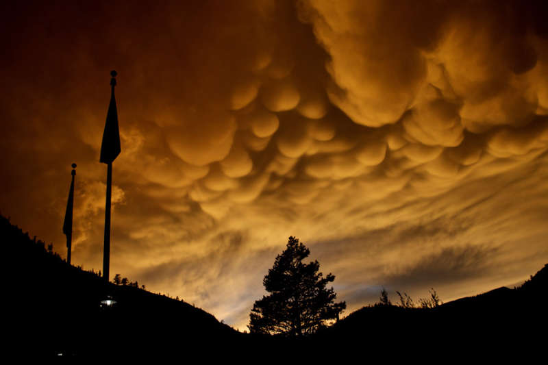
Explanation: What's happened to these clouds? Normal cloud bottoms are flat because moist warm air that rises and cools will condense into water droplets at a very specific temperature, which usually corresponds to a very specific height. After water droplets form that air becomes an opaque cloud. Under some conditions, however, cloud pockets can develop that contain large droplets of water or ice that fall into clear air as they evaporate. Such pockets may occur in turbulent air near a thunderstorm, being seen near the top of an anvil cloud, for example. Resulting mammatus clouds can appear especially dramatic if sunlit from the side. These mammatus clouds were photographed last August over Olympic Valley, California, USA.
|
January February March April May June July August September October November December |
| ||||||||||||||||||||||||||||||||||||||||||||||||
NASA Web Site Statements, Warnings, and Disclaimers
NASA Official: Jay Norris. Specific rights apply.
A service of: LHEA at NASA / GSFC
& Michigan Tech. U.
Based on Astronomy Picture
Of the Day
Publications with keywords: Mammatus clouds - california - sunset
Publications with words: Mammatus clouds - california - sunset
See also:
- APOD: 2025 December 30 Á An Artificial Comet
- APOD: 2025 December 22 Á Sunset Solstice over Stonehenge
- APOD: 2025 October 15 Á Rocket Launch Plume over Tucson
- APOD: 2025 June 15 Á Two Worlds One Sun
- APOD: 2020 August 2 Á Two Worlds One Sun
- Noctilucent Clouds, Reflections, and Silhouettes
- Shadowrise and Sunset
